SAFETY & ALERTS · SEPTEMBER 21, 2026 · UPDATED OCTOBER 14, 2026 · BY OUR GUIDES
Is Mount Sibayak Safe to Hike Right Now? What the Sinabung Alert Means for You
Sinabung is at Level III after erupting on 31 August 2026. Mount Sibayak is a different volcano about 15 km away — here is what that means for your trek.
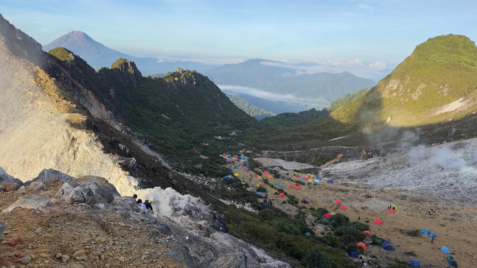
Sinabung erupted on 31 August 2026 and is still at Level III (Siaga). Mount Sibayak is a different volcano about 15 km away and is not inside Sinabung’s exclusion zone — but note the trail itself is closed to all hikers from 15 October to 15 November 2026 for ecosystem restoration (see our closure notice).
If you’ve booked a Sibayak trek and seen the news about Sinabung, you’re probably wondering whether to cancel. Here’s what’s confirmed, what isn’t, and how to decide.
Our status right now
Update 14 October 2026: Mount Sibayak is closed to all hikers from 15 October to 15 November 2026 under circular No. 100.3.4/1/UPTD TAHURA BB/X/2026 from UPTD Tahura Bukit Barisan, for ecosystem restoration and trail repairs. No trek can run in that window — see our closure notice for what it means for your booking.
The closure is unrelated to Sinabung: Sibayak sits outside all of Sinabung’s exclusion zones, 15 km away. Outside the closure period there is no exclusion zone on this mountain, and both departures — the half-day sunrise hike from Berastagi and the full-day trek from Medan — run as normal. We check conditions before every departure: the volcano’s status, the weather, and the trail itself.
If anything changes, we contact guests before their trek rather than after. You can also message us at any time and we’ll tell you plainly what we’re seeing on the mountain.
What happened at Sinabung
Sinabung erupted on the morning of 31 August 2026, sending an ash column roughly 3,500 m above the summit. It was the volcano’s first eruption in about five years, having sat at Level II (Waspada) since May 2023. PVMBG raised it to Level III (Siaga) the same day, and it has stayed there since.
The restrictions are specific and local. Nobody should be within 3 km of the summit, or in a 5 km sector running south-southeast. That sector began at 6 km and was reduced to 5 km by PVMBG on 6 September 2026 — so if you read an older figure, it has been narrowed. By 4 September about 650 people had registered as evacuees, and officials warn of lahars, the volcanic mudflows that run down rivers starting on Sinabung, especially after rain.
Ash is the part that affected visitors. It drifted east-southeast toward Berastagi, and the local disaster agency handed out masks in affected areas. Around 20 flights at Kualanamu were cancelled by 1 September, with the airport reported back to normal by 2 September.
Why it is still Level III
This is worth understanding, because “Siaga” sounds more alarming than the monitoring actually showed. PVMBG’s guidance of 6 September described activity that was already easing:
- Crater smoke white and thick, 300–500 m above the crater
- Drone flights found no new lava dome forming
- No rockfall earthquakes, meaning the existing dome is stable
- Magma-supply earthquakes still recorded, but not significant
- SO2 gas still elevated
So there was no new dome growth and no collapse signal, but SO2 remained high and deeper activity continued. That combination is why the level stays at III rather than dropping. BNPB has said further increases in activity are still possible.
Is Mount Sibayak part of this?
No. Sibayak is its own volcano, and its last eruption was in 1881. Its summit sits roughly 15 km east-northeast of Sinabung — comfortably outside both the 3 km summit radius and the 5 km sectoral zone. Sinabung’s restrictions are drawn around Sinabung. If you are still working out which mountain is which, our Sibayak vs Sinabung comparison settles it.
Sibayak also was not on the list of volcanoes at Level III. An independent volcano tracker still describes it as dormant, with steady steam activity and no eruptions.
We won’t pretend we can hand you a live reading here. MAGMA Indonesia, PVMBG’s own monitoring platform, publishes the current level for every monitored volcano in the country and it takes about a minute to check. Do that before you travel, and ask us on the day.
What still matters on the Sibayak trail
Sibayak’s hazards did not change when Sinabung erupted. They are the same ones we plan around every morning.
Ash and air. Berastagi was in the ash path. If ash is falling on the day of your trek, we postpone — a volcano is not worth climbing through ashfall. Carry a proper mask either way, and we bring them regardless.
Sibayak’s own gas. Even a volcano sitting at Level I (Normal) can have dangerous gas. The fumaroles at the crater vent sulfur dioxide continuously, and the concentration shifts with wind direction. Don’t linger near the vents, move upwind when the smell turns sharp, and stay on your guide’s line. Our full procedure is in the hiking guide’s safety section.
Slippery ground and fast weather. The trail goes slick with moss, and highland weather turns quickly. Lightning is a genuine hazard here rather than a theoretical one — there have been reported cases of climbers struck near Jaranguda, including a father and his young child at the crater edge.
The early start. Navigating unlit volcanic terrain before dawn is the part most people underestimate. If you are unsure whether the climb suits you, the difficulty guide is honest about it.
Before you go
- Check both volcanoes on MAGMA Indonesia — Sibayak’s level, and Sinabung’s.
- Watch the weather. Ash risk aside, conditions decide whether a sunrise is worth the alarm. Our best time to climb guide covers the dry and wet seasons.
- Stay out of the Sinabung exclusion zones. That includes the Lau Kawar area at the foot of the mountain, where access has been closed during volcanic activity. Check before planning anything on that side of the highlands.
- Flying into Kualanamu? Check with your airline the day before. Ash disruptions in early September had the airport briefly disrupted, though it was reported normal again by 2 September.
- Ask us. If you’re booked and something looks off in the news, message us and we’ll tell you what we’re actually seeing. Other ways to reach us.
What we don’t know
We don’t know how Sinabung will behave over the coming weeks. And we haven’t seen any official notice closing Sibayak’s routes — but that is not the same as proof the trails are open, which is why we confirm with the park office and check the route ourselves rather than assume.
The most recent PVMBG guidance we can verify is dated 6 September 2026. If you are reading this later, check MAGMA for anything newer before you rely on it.
If Sibayak’s status ever moves above Level I (Normal), or ash is falling on the trail, we don’t go. That isn’t a judgement call.
Sources
- PVMBG advisory as reported by Tribun Medan — reduced Sinabung danger zone, 7 September 2026
- BNPB — Gunung Sinabung Erupsi, Status Aktivitas Naik Menjadi Level III Siaga
- ANTARA — Gunung Sinabung naik status menjadi siaga
- Tempo — Gunung Sinabung Meletus Hari Ini, Status Naik Jadi Siaga
- detik — Gunung Sinabung Berstatus Siaga, Warga Diimbau Mengungsi
- Kompas — Berastagi diselimuti abu, status naik jadi Siaga
- Liputan6 — Hikers struck by lightning at Mount Sibayak, Jaranguda
- JPNN — Bapak dan Anak Tersambar Petir Saat Mendaki Gunung Sibayak
- MAGMA Indonesia — PVMBG / Badan Geologi
- Wikipedia — Mount Sibayak
- Wikipedia — Mount Sinabung
Frequently asked questions
Is Mount Sibayak safe to climb right now?
Is Mount Sibayak affected by the Sinabung eruption?
How far is Mount Sibayak from Mount Sinabung?
Can I still do the Mount Sibayak sunrise trek?
What should I do if volcanic ash is falling?
How do I check Mount Sibayak's current status myself?
Researching difficulty, weather, or preparation?
Read the full Mount Sibayak hiking guide for route overview, difficulty, preparation, and safety tips before you plan the trek.
If you are comparing conditions, start with our Mount Sibayak weather and best time guide.
Planning around a specific date?
Message us the dates you're in North Sumatra and we'll tell you honestly what to expect — and whether to climb at all.
Ask on WhatsApp