ADVENTURE TRAVEL · SEPTEMBER 28, 2026 · BY OUR GUIDES
Sibayak vs Sinabung: Which Volcano Is Which?
Mount Sibayak and Mount Sinabung are separate volcanoes about 15 km apart near Berastagi. How to tell them apart — and which one you can actually climb.
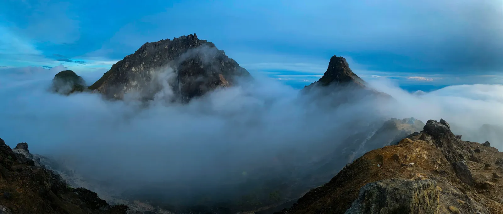
Sibayak and Sinabung are two separate volcanoes in Karo, North Sumatra, about 15 km apart. Sibayak (2,212 m) is the one with the established sunrise hiking route. Sinabung (2,460 m) is taller, far more active, and closed to hikers.
Look across the Karo Highlands from Berastagi and you will hear two names again and again: Mount Sibayak and Mount Sinabung. They are easy to mix up. Both are volcanoes in Karo, both are visible from the highlands, and from certain viewpoints one can look like part of the same group of mountains.
They are not.
The simple answer
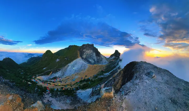
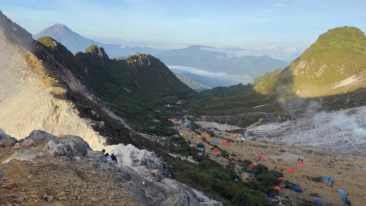
Mount Sibayak is the volcano beside Berastagi that travellers climb for a sunrise hike. Its summit holds a rugged crater, fumaroles, sulfur deposits and an established trail.
Mount Sinabung is the higher and far more active one. It has a long record of eruptions, including renewed activity in 2026, and exclusion zones around it mean it should never be treated as a second hiking option.
| Mount Sibayak | Mount Sinabung | |
|---|---|---|
| Position | Beside Berastagi, ~5 km north-northwest of town | ~15 km west-southwest of Sibayak |
| Elevation | About 2,212 m | About 2,460 m |
| Main character | Rugged crater, fumaroles, geothermal features | Steep cone, active eruptive system |
| Visitor experience | Sunrise hiking and crater exploration | Observed from a distance; summit access restricted |
| Recent activity | Last recorded eruption in 1881 | Repeated eruptions, including August 2026 |
| Normal tourist hike? | Yes, established routes | No — exclusion zones apply |
Sibayak: the crater you hike
Sibayak does not look like the classic symmetrical volcano you might picture. Its summit is rugged and shaped by geothermal activity — the Smithsonian Global Volcanism Program’s entry for the Singkut volcanic complex, which includes Sibayak, describes sulfur mineralisation, hydrothermal alteration and active fumaroles.
That geothermal character is what makes a Sibayak hike feel unlike an ordinary mountain walk. As you approach the crater the vegetation gives way to exposed volcanic rock, steam rises out of the ground, and the sulfur smell near the fumaroles is unmistakable.
It is also why the mountain should not be dismissed as just an easy hill. Sibayak is accessible compared with most Indonesian volcanoes, but the crater is still a live volcanic environment and the vents deserve respect. Our full hiking guide covers the routes, the checkpoint fee and the trail conditions.
Sinabung: the volcano you watch
Sinabung reaches about 2,460 m and has a much more recent eruptive history. The Global Volcanism Program records confirmed eruptive periods from 2010 onward.
In 2026 it became active again. On 31 August an eruption produced an ash column reported at around 3.5 km above the summit, and Badan Geologi raised the volcano from Level II (Waspada) to Level III (Siaga). By early September, monitoring showed activity easing — crater smoke 300–500 m, no new lava dome on drone survey, and no rockfall earthquakes — while SO2 remained elevated, which is why the status stayed at Level III rather than dropping.
Sinabung is not “the taller Sibayak.” It is a different volcano with a different hazard profile, and that difference is the whole point.
Can you hike Mount Sinabung?
No. Do not treat it as a second option alongside Sibayak.
Ongoing activity means authorities maintain exclusion zones around the volcano. During the 2026 activity, Badan Geologi’s recommendations prohibited access within a radius of the summit, plus additional sector-specific restrictions that were revised as conditions changed. The south-southeast sector was narrowed from 6 km to 5 km on 6 September.
Those restrictions move with the volcano, so anyone weighing up activity near Sinabung needs current PVMBG or MAGMA information — not last year’s hiking article, and not a social media post.
Which one are you looking at?
This is where the confusion usually starts.
From Berastagi, Sibayak is the mountain right above town, the one you drive toward and then walk up. Sinabung lies the other way, to the west-southwest, around 15 km off.
The quickest way to tell them apart is steam. On an active day Sinabung carries a plume above its summit. Sibayak’s steam stays inside its crater rather than rising clear of the rim, so from a distance Sibayak can look like nothing more than a ridge, while Sinabung announces itself.
They are close enough to appear in the same photograph, which is exactly why people assume they are one massif. The easiest way to remember them:
Sibayak is the crater you hike. Sinabung is the volcano you watch.
Is Sibayak affected by Sinabung?
They are separate volcanoes, but conditions around one can still matter for the other — and that is a genuine source of confusion rather than a silly one.
During the 31 August 2026 eruption, ash from Sinabung drifted toward Berastagi. It is a good illustration of why the practical question for a Sibayak trek is not simply “is Sinabung erupting?” but “what are conditions around Sibayak and the surrounding area right now?”
That question is covered properly, with the current operational status, in our Mount Sibayak safety guide. For seasonal planning instead, see the best time to climb guide.
Planning the trek
Staying in Berastagi? See the Mount Sibayak sunrise trek from Berastagi. Coming from Medan? See the full-day trek from Medan.
You can also compare Mount Sibayak difficulty, Mount Sibayak price, and the sunrise trek from Medan before you decide.
Sources
- Smithsonian Global Volcanism Program — Singkut volcanic complex, which includes Sibayak
- Smithsonian Global Volcanism Program — Mount Sinabung
- Badan Geologi / PVMBG — Sinabung raised to Level III (Siaga), 31 August 2026
- PVMBG advisory as reported by Tribun Medan — reduced Sinabung danger zone, 7 September 2026
Frequently asked questions
Is Mount Sibayak the same as Mount Sinabung?
Which is higher, Sibayak or Sinabung?
Can you see Sinabung from Mount Sibayak?
Can you climb Mount Sinabung?
How far apart are Mount Sibayak and Mount Sinabung?
Researching difficulty, weather, or preparation?
Read the full Mount Sibayak hiking guide for route overview, difficulty, preparation, and safety tips before you plan the trek.
If you are comparing conditions, start with our Mount Sibayak weather and best time guide.
Planning around a specific date?
Message us the dates you're in North Sumatra and we'll tell you honestly what to expect — and whether to climb at all.
Ask on WhatsApp